Mount Marion Point - Saugerties, NY
Mount Marion Point – Dog-Friendly Hiking in Saugerties, New York
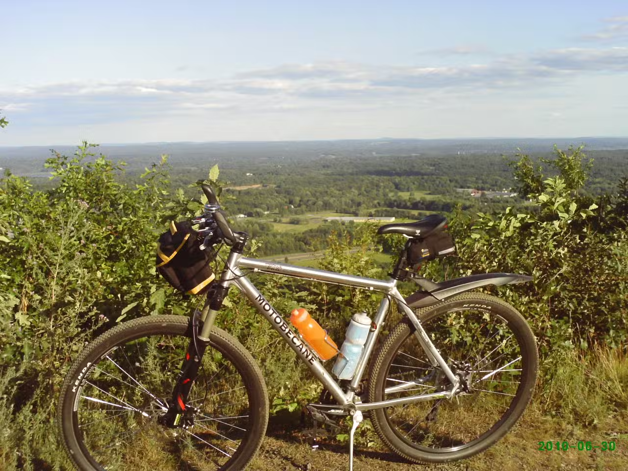
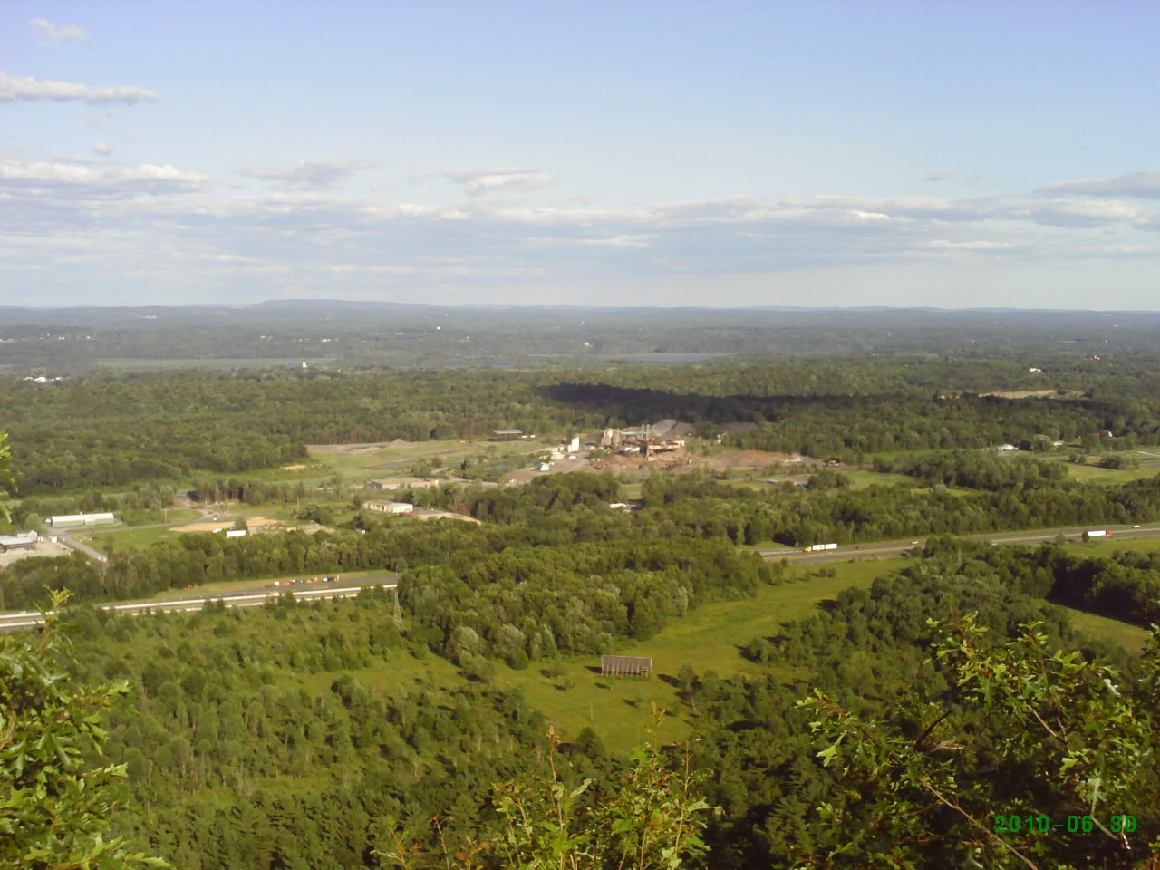
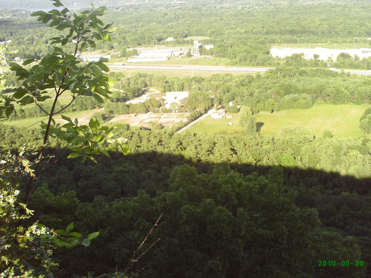
If you’re looking for scenic dog-friendly hiking in the Saugerties, NY area, Mount Marion Point offers an adventurous option for outdoor enthusiasts and their four-legged companions. Nestled near the Hudson Valley with dramatic views of the Catskills and the Berkshires, this local trailhead presents a moderate-to-hard trail – perfect for those seeking a challenging day hike with their pets. The summit rewards persistent hikers with breathtaking vistas, making it a favorite spot among locals for dog-friendly outings.
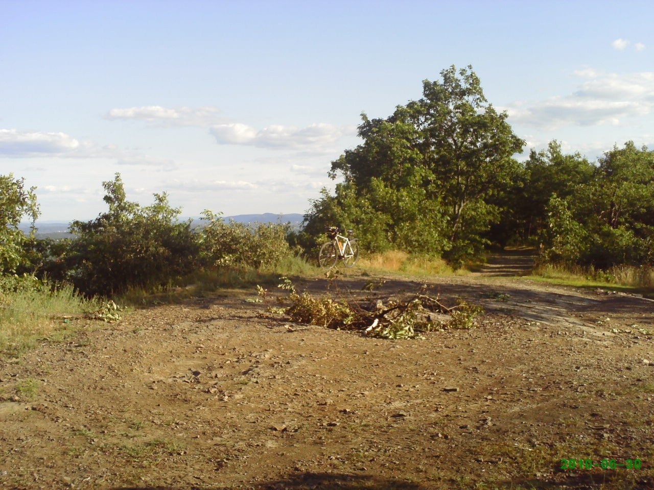
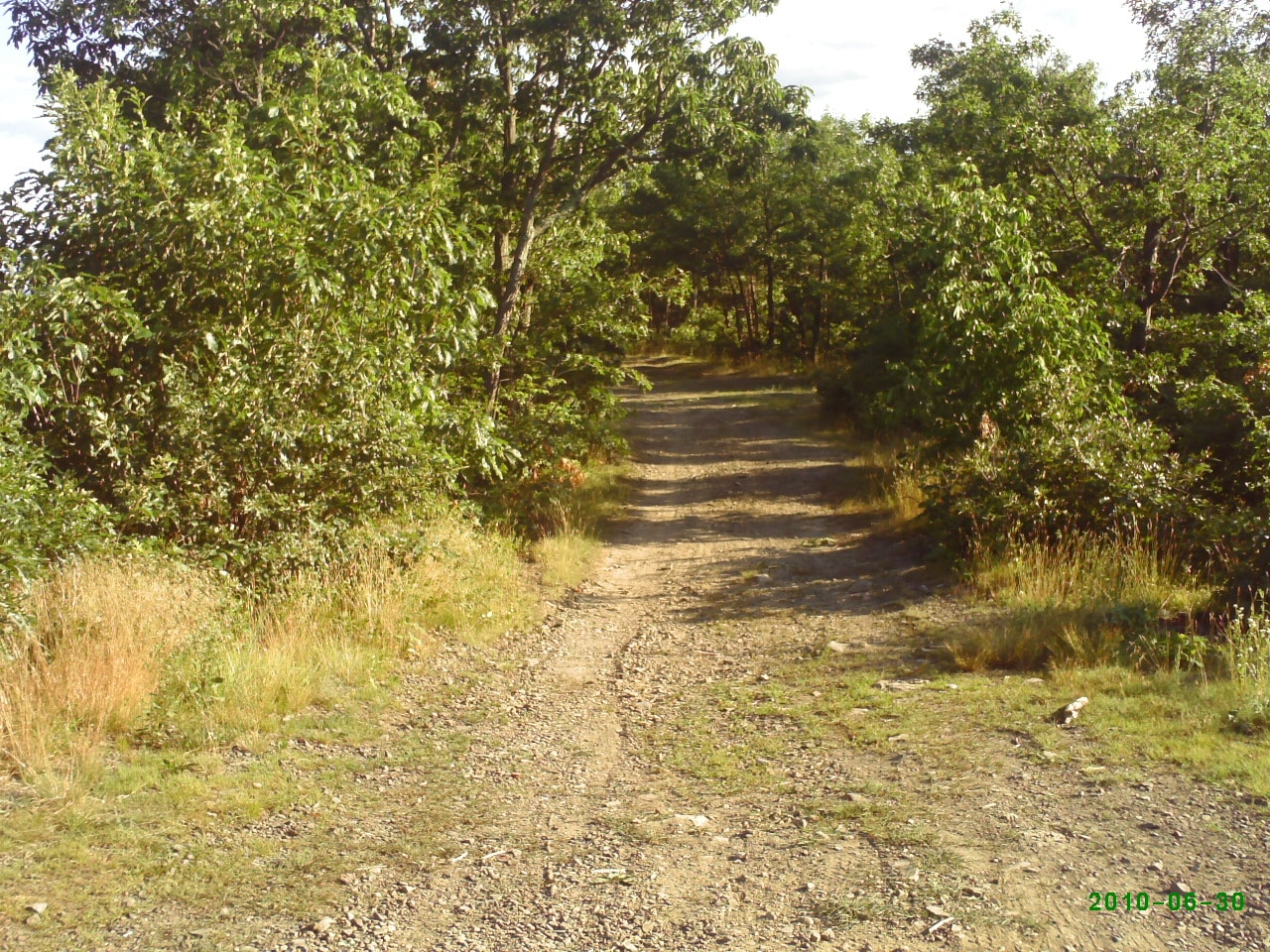
While Mount Marion Point is renowned for its natural scenery, rugged terrain, and peaceful setting, dog owners should be aware that official amenities are minimal. Parking can be tricky, and the trail entrance is not always clearly marked – it’s recommended to park safely and be cautious of private property boundaries. The park offers open grassy spaces and some shaded areas, but there is no fenced or designated off-leash dog area, so leashes are advised. After rainy weather, the paths can become muddy, so plan accordingly!
Frequently Asked Questions
- Are dogs allowed at Mount Marion Point? Yes, dogs are allowed on the trail. Please keep them leashed for safety, as the area is not fenced and there may be hunters and other hazards nearby.
- Where is the best place to park? Parking is available by the former gristmill, which is safer than street-side parking. Be mindful of unclear trail markers and private property boundaries when accessing the trailhead.
- Are there any pet-friendly hiking trails connected to this park? Yes, Mount Marion Point is known for its steep, pet-friendly hiking trail with spectacular views. There are no designated small or large dog areas, but the hike is suitable for leashed dogs comfortable with tough climbs.
- Is the park muddy after it rains? Yes, several reviews note that the grassy areas and trails can become muddy, so prepare with appropriate footwear and expect wet conditions after rainfall.
- Is there shade available? There are shaded areas thanks to trees along the trail, making it a pleasant hike during warmer months.
Reviews
This is private property, not a public trail. People also hunt here so you may get shot at.
This is private property, not a public trail. People also hunt here so you may get shot at.
The actual point is about 150m SSE of where it’s marked on the map. Nice view of 87 and the Hudson over a dramatic drop. You cannot get here from the east unless you want to scale a cliff face.
The actual point is about 150m SSE of where it’s marked on the map. Nice view of 87 and the Hudson over a dramatic drop. You cannot get here from the east unless you want to scale a cliff face.
Don’t listen to Google – it will take you to a closed off area with signs that say “BLASTING ZONE – DANGER – DO NOT ENTER” plus a lot of private property. I did see two areas on the bend of the road that probably were the trailhead that people were referencing in the other reviews, but it’s not clear that you can park there legally and who wants to take that risk. There was also a hunting bench at the blasting zone. This should probably be removed from Google Maps given the safety and legitimacy as getting shot is unfortunately a real possibility. God bless America.
Don’t listen to Google – it will take you to a closed off area with signs that say “BLASTING ZONE – DANGER – DO NOT ENTER” plus a lot of private property. I did see two areas on the bend of the road that probably were the trailhead that people were referencing in the other reviews, but it’s not clear that you can park there legally and who wants to take that risk. There was also a hunting bench at the blasting zone. This should probably be removed from Google Maps given the safety and legitimacy as getting shot is unfortunately a real possibility. God bless America.
Couldn’t find the spot on Churchland road for the trailhead. Further, Google maps at first took me to the opposite side of the point which involved closed roads and private property. Unless someone can show you where to park and enter the trailhead, don’t waste your time.
Couldn’t find the spot on Churchland road for the trailhead. Further, Google maps at first took me to the opposite side of the point which involved closed roads and private property. Unless someone can show you where to park and enter the trailhead, don’t waste your time.
A little known local trail that leads uphill from a bend in Churchland Road, Saugerties, and brings you out atop the 650 foot peak at Mount Marion Point. Even though it is not as tall as other peaks in the Catskill foothills, there are some spectacular views and you can see an expansive Hudson Valley and even the Berkshires on a clear day.
A little known local trail that leads uphill from a bend in Churchland Road, Saugerties, and brings you out atop the 650 foot peak at Mount Marion Point. Even though it is not as tall as other peaks in the Catskill foothills, there are some spectacular views and you can see an expansive Hudson Valley and even the Berkshires on a clear day.