Eagle Creek Trailhead (Clackamas County) - Sandy, OR
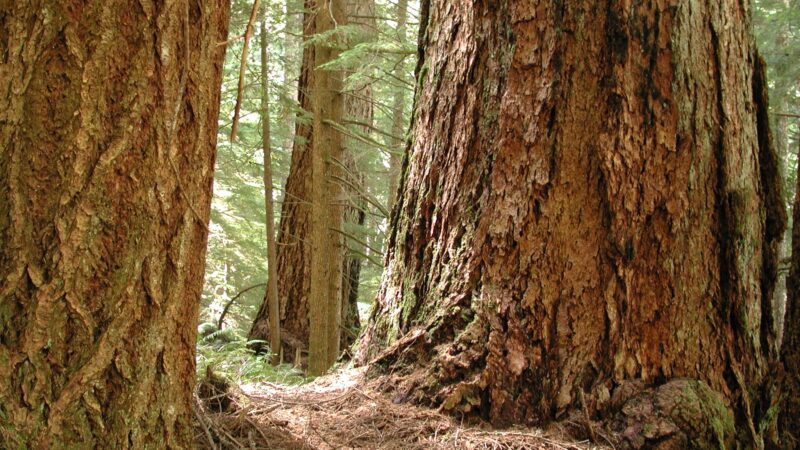
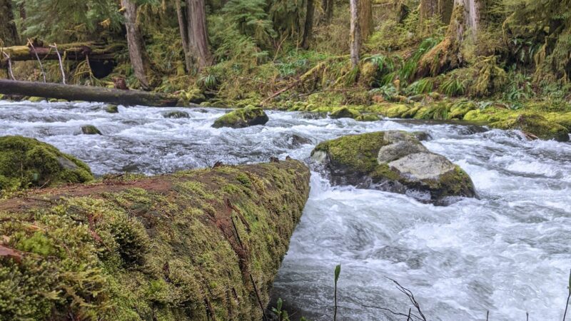
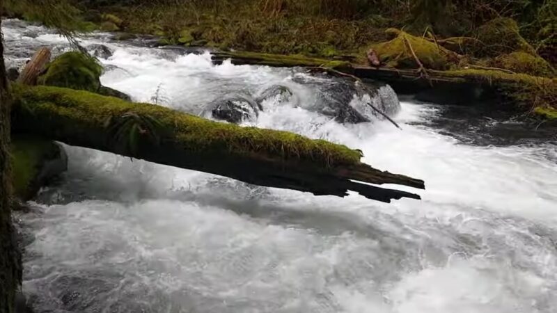
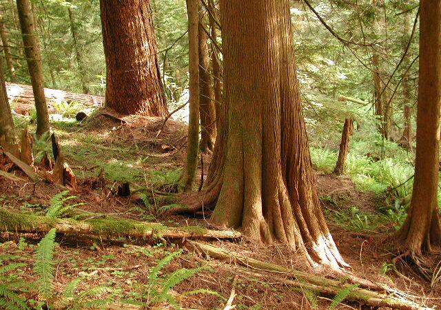
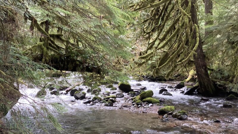
Eagle Creek Trailhead in Clackamas County is a scenic gateway to the lush forests near Sandy, Oregon, offering pet-friendly hiking for outdoor enthusiasts and their canine companions. The trailhead provides access to beautiful old-growth woods, gentle slopes, and tranquil creekside stretches – perfect for leashed walks with your dog. Visitors praise the quiet, uncrowded experience and the opportunity to explore winding wilderness trails and picturesque campsites surrounded by towering trees and soft moss.
While Eagle Creek Trailhead is primarily a wilderness area and not a dedicated dog park, it remains a popular spot for dog-friendly hiking in Sandy, OR. Please note, leash rules are strictly enforced here due to wildlife and wilderness regulations – dogs must be on-leash at all times. The area offers ample parking at the trailhead turnaround, and the tranquil, natural environment makes it a favorite for families and responsible dog owners seeking a more rustic, off-the-beaten-path adventure in Clackamas County.
FAQ
- Are dogs allowed off-leash at this park? No, dogs must be on-leash at all times in the wilderness area.
- What are the park’s leash requirements? All dogs must remain on a leash to protect both wildlife and other park visitors.
- Is there a fenced area for dogs? No, there are no fenced dog areas at this trailhead.
- Are there walking or hiking trails connected to the park? Yes, Eagle Creek Trailhead is the starting point for several pet-friendly hiking trails through the forest.
- Is there parking available? Yes, there is a turnaround area with space for parking several vehicles at the trailhead.
- Is there shade or shelter available? The trails pass through forested areas offering natural shade from large, mature trees.
- Is the park muddy after it rains? Sections of the trail can become muddy or feature water crossings after rain, so be prepared for wet and slippery conditions.
Reviews
No access as of 3/30/25.
Entering any wilderness area requires permission, a permit. A permit to enter a wilderness area is a binding contract. You are agreeing to the rules. These permits are self issuing in many cases. We all expect everyone else to be respectful and obey the rules. A wilderness area is not a good place to bring an off leash dog. It is not fair to the other users and the wildlife. Leash the dogs you bring, if you have to bring dogs to explore wilderness with you. I totally get it, letting a dog run free. It’s fun. I also totally agree with the leash rules. There are plenty of places in the national forest you can take dogs to let them run free. I’m sorry if this conflict effects your ability to get into wilderness areas. Having a dog is a choice. A choice which comes with responsibility. Every wilderness area recommends not bringing a dog. Seriously, EVERY wilderness area recommends NOT bringing a dog. People are leaving green plastic poop bags on the trail in wilderness areas. Cmon, y’all. Don’t disrespect yourself. Don’t disrespect others.
Some people come out here thinking its a park. It is not. It is Wilderness area. There are cougars and bears. Its smart to have a firearm with you. If you dont like to run into dogs running down the trail or people hunting, dont come down here. If you like to see free and wild areas its great.
Some people come out here thinking its a park. It is not. It is Wilderness area. There are cougars and bears. Its smart to have a firearm with you. If you dont like to run into dogs running down the trail or people hunting, dont come down here. If you like to see free and wild areas its great.
Road in is bumpy but my Subaru Outback handled it well. Some nice campsites 2-3 miles in. Lots of big trees, moss. Beautiful old growth forest. The trail is a gradual slope so not too steep but definitely some elevation gain on the way back up. Trail mostly clear except for a few fallen trees here and there.
Road in is bumpy but my Subaru Outback handled it well. Some nice campsites 2-3 miles in. Lots of big trees, moss. Beautiful old growth forest. The trail is a gradual slope so not too steep but definitely some elevation gain on the way back up. Trail mostly clear except for a few fallen trees here and there.
Google incorrectly showed the road ending early. This caused it to give incorrect directions to turn early at a gated road. I moved the trailhead to the end of the road as mapped.
The trailhead is at 45.30209, -122.13556. Go down the middle road and it quickly narrows to a trail.
As of January 2023 there was a tree across the road to the trailhead and people are parking at the road junction.
Also be aware that the trail has water running across it at several locations and that there are downed trees to navigate. My sister had to lift her elderly german shepherd over a log and had to carefully guide her past some of the downed debris.
This trail is open, and there is no locked gate (10/16/22). You must drive through Weyerhaeuser land to get there, but Harvey Road is a public right of way. So you will see gates and no trespassing signs along the road but just follow Harvey Road. If you try getting here from a different road, it will be blocked. The road is gravel, but passable – one spot has a pretty big pothole, but I managed to get around it in my 2wd hatchback. There is a big turnaround at the trailhead – room enough for several cars to park.
We didn’t meet a single person! Sort of a long gradual descent into the valley bottom, then roughly parallels the stream. Some nice places to camp or have lunch a couple miles in. Pretty stream, some big old honking trees. Nice hike!
I was gonna give it four stars, but I feel like people giving it one star because they didn’t bother looking at a map doesn’t seem fair, so I’m giving it 5 to make up for it.