Mountainside Park - Pompton Plains, NJ


Mountainside Park – A Dog-Friendly Hiking Haven in Pompton Plains, NJ
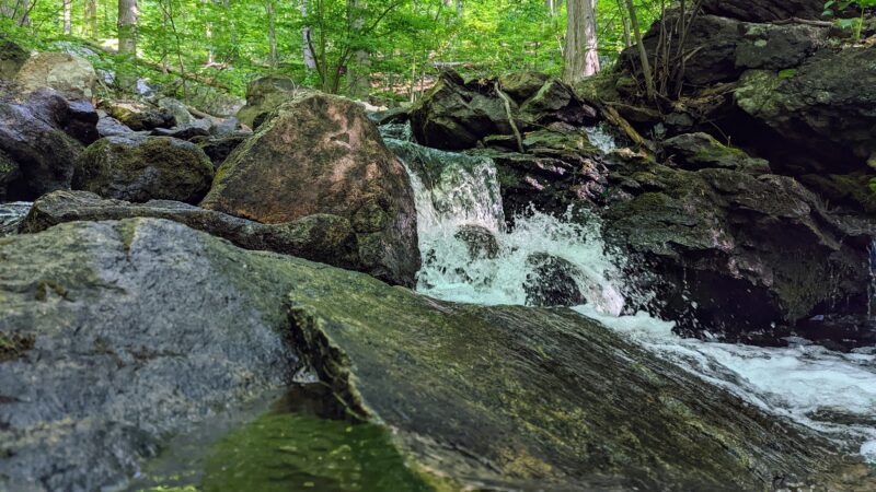
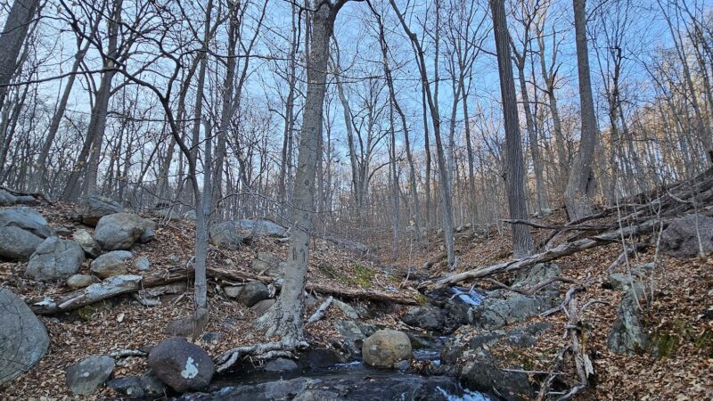
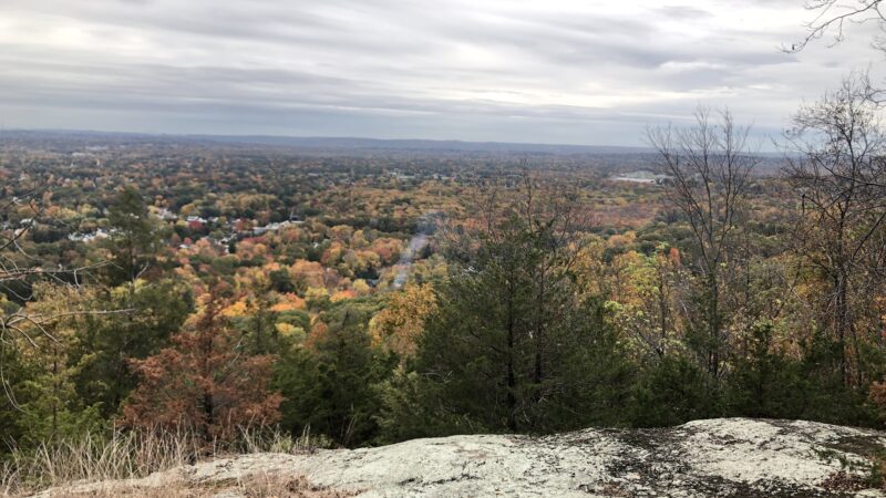
Mountainside Park offers a scenic and pet-friendly escape for dog owners in Pompton Plains, New Jersey. Known for its well-marked hiking trails, moderate climbs, and panoramic overlooks, this park is a favorite for outdoor enthusiasts and their four-legged companions. With multiple trails—including the blue, orange, yellow, and red loops—the park provides a variety of routes perfect for hiking alongside your dog. The area is praised for its beautiful views, relaxing atmosphere, cleanliness, and tranquil streams along the way.
While there is not a dedicated, fenced-in dog park section, leashed dogs are welcome to enjoy the trails and open natural areas with their owners. Shade from trees and benches at the main overlook offer rest spots for both people and pets. The parking area is limited, fitting about 5-7 cars, but additional parking can be found along the nearby road. Mountainside Park is ideal for those searching for dog-friendly hiking in Pompton Plains, complete with gorgeous scenery and family-friendly amenities.
Frequently Asked Questions
- Are dogs allowed off-leash at this park? Dogs are welcome but must remain on leash throughout the park and hiking trails.
- Are there benches or seating areas for owners? Yes, there are benches at the main overlook.
- Is there shade or shelter available? There is plenty of natural shade from trees throughout the trails and at the overlook.
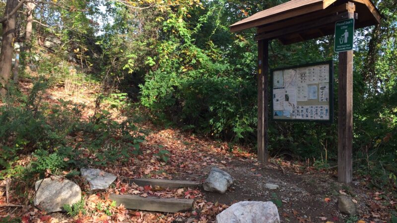
- Where is the best place to park? The main parking lot fits about 5-7 cars, but you can park along the road near the water tower if the lot is full. Make sure to enter via Mountain Ave Park, not the senior living community.
- Are there walking or hiking trails connected to the park? Yes, there are multiple hiking trails of various lengths and difficulty within Mountainside Park.
- Is the park muddy after it rains? Some trails can get muddy and slippery, especially near streams and after rain—wear appropriate footwear.
- Are ticks or other pests common in the area? Yes, visitors have noted the presence of ticks; it’s important to check yourself and your dog after a visit.
- How busy does the park get on weekends? The park is moderately busy; parking can be limited during peak times, especially in the afternoon.
- Is there a playground or activities for kids nearby? Yes, the park is family-friendly, and children enjoy playing in the area.
Reviews
Watch out for poison ivy. Nice hike can get muddy.
Watch out for poison ivy. Nice hike can get muddy.
Great easy to moderate hiking park. It offers different loop options. Please keep it clean.
Great easy to moderate hiking park. It offers different loop options. Please keep it clean.
Pretty great moderate-length hike for a great overlook.
We basically walked around the perimeter of the park through the blue, then orange, and then red trails.
Note that there are kind of 2 overlooks. The first overlook (not indicated on the map), is on the blue trail, at the east most part of the trail where it “juts out”, before the orange trail juts out. You’ll see a road and a fence when looking out on this overlook. This is not the overlook that is indicated by a star on the map.
As you continue north, you’ll know that you’re getting close to the main overlook when the trail starts getting much, much steeper. And if you have poles, remember to bring them and use them. Poles will help when going up, and they definitely will help when going down; it’s very easy to slip on gravel given the steepness of some parts. Also, side note — these trails are very rocky, so make sure to wear hiking boots/shoes with adequate ankle support.
The main overlook is a pretty wide open area, and there will be benches. You’ll see the start/end of the orange trail blaze markings. And as of 10/15/2022, you’ll see a banged-up, black snowboard that has K2 written on it, which is pretty funny.
Overall, pretty great place to hike. I wish the map was more detailed in showing land marks like bridges, foot bridges, the backpacking shelter, the 2 exhaust pipes that smelled like chlorine (not sure what that was), etc… just to get bearings when hiking, since the trails can get confusing with the many intersections.
Also, the parking lot fits maybe 5 cars, but you can park on the side of the road that leads to the parking lot. We hiked on a Saturday afternoon, and interestingly there were maybe 4 other cars when we got there, but when we finished hiking 2 and a half hours later (and closer to sunset), there were like 10.
Love this mountain! Well maintained and clean . Come more times to try all the trails definitely!!!! Att my hiking track FYI. I took yellow, orange, then blue trail this time.
Parking lot is tiny, only fit for six or seven cars. Google Map would navigates you to the senior living community by the mountain if pin at Mountainside park. DO NOT TRUST GOOGLE AT THIS POINT!! There’s no way to go to any trails from the living community! Be sure that Mountain Ave Park is the destination on you GPS, which takes you to the trails entrance/ mini parking lot.
At least three clear and safe streams, and two camping spots (all are incl. fire space and lean-to.) family friendly mountain!!!!
This is a hard to get to park, punch in the mountain park on google maps and it’ll try and take you to cedar rd, which is the over 55 community. Which happens to be a closed off road. Once I finally found the place parking is very limited and tight, my suggestion would be to park along the road by the water tower. The trails are steep in some places but overall it’s a nice trail, it understand that in some places it hasn’t been maintained very well. Volunteers needed. That an I got my feet a little muddy because of the streams running across the paths.
Update 10/15/2018 I woke up with a pain in my arm to find a tick, so please be warned and careful when in these woods, check yourself and the dog. Had it tested not a deer tick with lymes. Thank god because ive had it before or still do.