Capoolong Creek Trailhead Landsdown - Pittstown, NJ


Capoolong Creek Trailhead Landsdown: A Dog-Friendly Outdoor Adventure in Pittstown, NJ
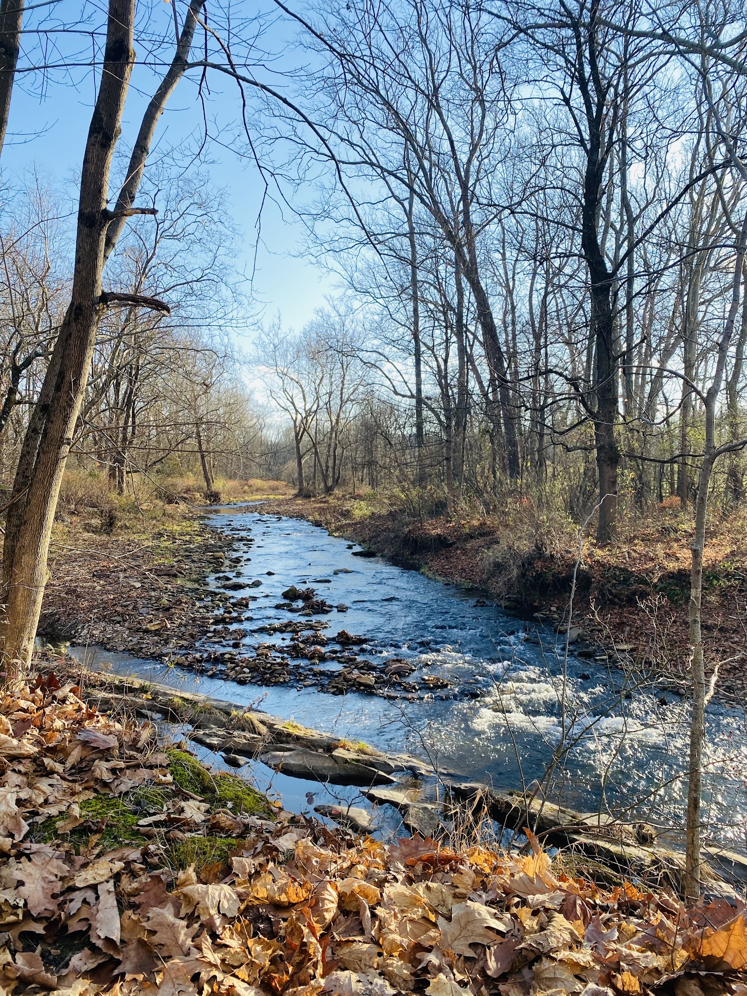
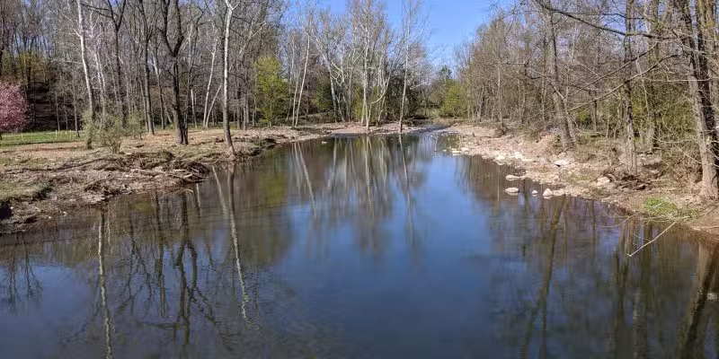
Discover the scenic beauty of Capoolong Creek Trailhead Landsdown, nestled within the Capoolong Creek Wildlife Management Area in Pittstown, New Jersey. This pet-friendly trail offers dog owners a peaceful escape with scenic views of the Capoolong Creek, lush woodlands, and glimpses of local history such as the old Pittstown Railroad Station. While it isn’t a traditional fenced dog park, this trail is a great destination for dog-friendly hiking and leashed walks in Hunterdon County, just minutes from the highway.
The Capoolong Creek Trail varies in its maintenance – some sections are well-worn and easy to follow, while others may be overgrown and muddy, especially after wet weather. Be prepared for a more rustic adventure and keep your dog on a leash, as the trail borders private property and is not fully enclosed. Despite some closures and less-frequented stretches, the trail’s tranquil setting and rural charm make it a favorite for nature-loving pet owners seeking a quieter, underused spot for exercise with their furry companions.
FAQ
- Are there walking or hiking trails connected to the park? Yes, Capoolong Creek Trail is a dog-friendly hiking trail with several access points, offering scenic routes through the area.
- What are the park’s leash requirements? Dogs should be kept on leash, both for their safety and the privacy of adjacent landowners.
- Is the park muddy after it rains? Some sections of the trail can be muddy or swampy after rainfall, so proper footwear and caution are recommended.
- Is the park regularly cleaned and maintained? Maintenance varies along the trail. Some parts may be overgrown, so be prepared for natural conditions.
- Is there shade or shelter available? The trail is surrounded by wooded areas that offer natural shade in most parts.
- Is there parking available? Parking is generally available at the trailheads, though specific lot details may vary.
- Is the park open year-round? The trail is accessible year-round, but some sections may close due to flooding or maintenance.
Reviews
very underused and not well-maintained, literally only 12 inches wide in most spots with grass along side that have been mowed in some areas, but not others between Lansdowne and Pittston unable to do the last leg as the grass was just too high. But I was on my bicycle so that might’ve made a difference. other parts of the trail a mower had been through and cut the tall grass down, and that was fine for riding along, but as soon as the grass grew too tall, and I could not see what was hiding such as rocks and tree roots, I stopped and turned around, so walk or ride this at your own risk.
very underused and not well-maintained, literally only 12 inches wide in most spots with grass along side that have been mowed in some areas, but not others between Lansdowne and Pittston unable to do the last leg as the grass was just too high. But I was on my bicycle so that might’ve made a difference. other parts of the trail a mower had been through and cut the tall grass down, and that was fine for riding along, but as soon as the grass grew too tall, and I could not see what was hiding such as rocks and tree roots, I stopped and turned around, so walk or ride this at your own risk.
very underused and not well-maintained, literally only 12 inches wide in most spots with grass along side that have been mowed in some areas, but not others between Lansdowne and Pittston unable to do the last leg as the grass was just too high. But I was on my bicycle so that might’ve made a difference. other parts of the trail a mower had been through and cut the tall grass down, and that was fine for riding along, but as soon as the grass grew too tall, and I could not see what was hiding such as rocks and tree roots, I stopped and turned around, so walk or ride this at your own risk.
The northern trailhead. Unfortunately as of winter 2024 the northern 2/3 of the trail are closed. Recently flooding has seriously damaged sections of the trail. We were told by a local that there is an effort to revitalize it.
The northern trailhead. Unfortunately as of winter 2024 the northern 2/3 of the trail are closed. Recently flooding has seriously damaged sections of the trail. We were told by a local that there is an effort to revitalize it.
The northern trailhead. Unfortunately as of winter 2024 the northern 2/3 of the trail are closed. Recently flooding has seriously damaged sections of the trail. We were told by a local that there is an effort to revitalize it.
Hiked the entire trail from Landsdown to Pittston on Jan 14, 2023. Decent trail, quiet, little bit of mud. Presently a portion of the trail was marked with a “Closed” sign but it was passable.
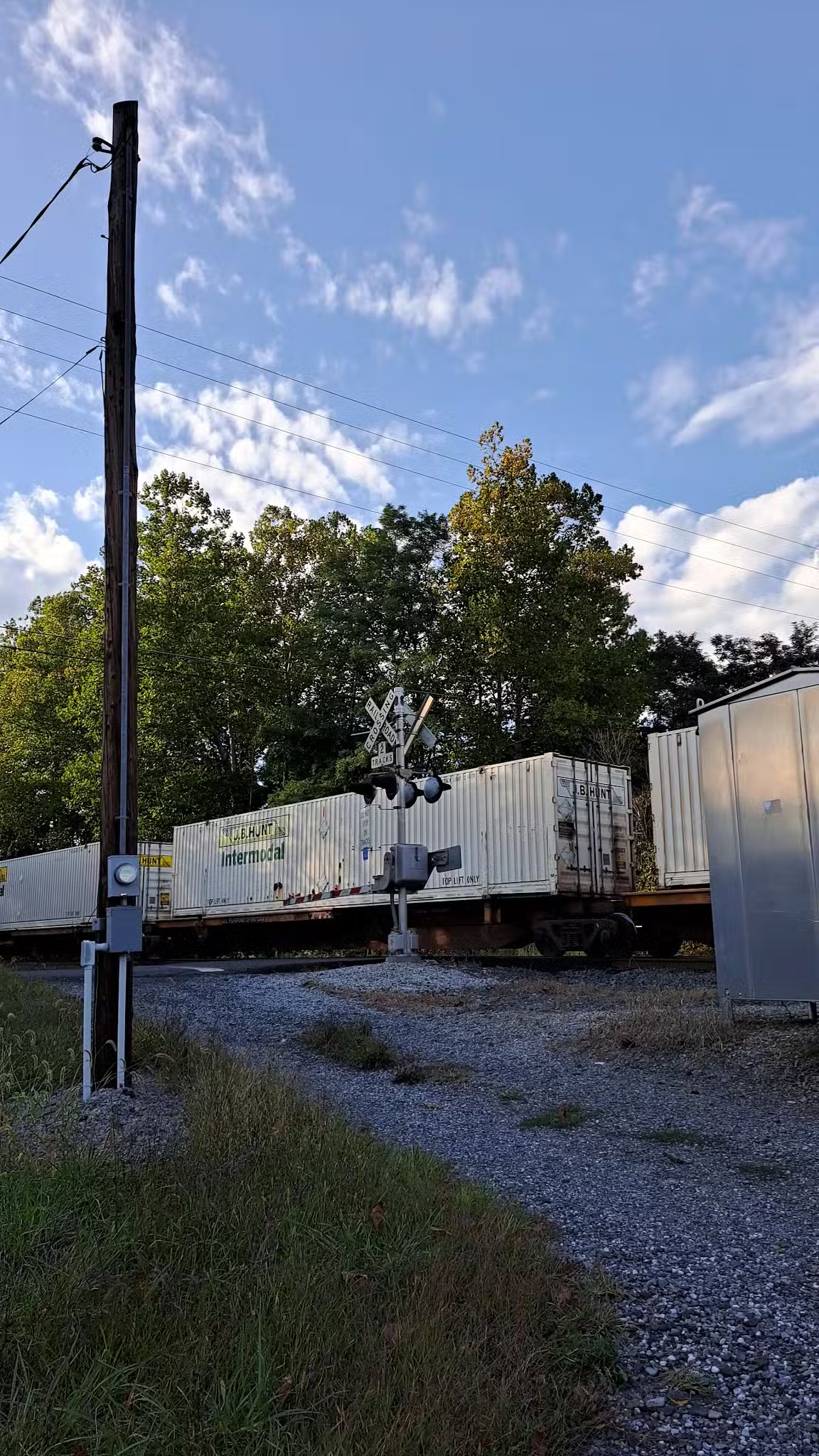
Important: the southern end of the trail in Pittston has surprises: a couple boarded up buildings along the trail that appear to be the freight houses for the old Pittston train station. Also, this end has no public access and is technically a dead end because it ends at the private driveway of 381 and 383 Pittstown Road so you really need to walk back to White Bridge Road for public access.
Hiked the entire trail from Landsdown to Pittston on Jan 14, 2023. Decent trail, quiet, little bit of mud. Presently a portion of the trail was marked with a “Closed” sign but it was passable.
Important: the southern end of the trail in Pittston has surprises: a couple boarded up buildings along the trail that appear to be the freight houses for the old Pittston train station. Also, this end has no public access and is technically a dead end because it ends at the private driveway of 381 and 383 Pittstown Road so you really need to walk back to White Bridge Road for public access.
Nice local trail that until recently was little used. The Capoolong is a beautiful creek and runs through some of the most scenic parts of Hunterdon County. It’s hard to believe you are only 5 minutes from the highway.
The trail head to the first Kingtown Road entrance is fairly well worn and marked. From there is seems to be less travelled and maintain. It can narrow down to a footpath and be a bit wet depending on the time of year, so proper foot wear is key.
Some of my favorite highlights are the now dilapidated Pittstown Railroad Station and the scenic Whitebridge section.
This trail goes along a lot of private property, which includes the Creek. Pay attention to the Posted signs.