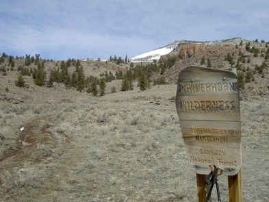
Powderhorn Wilderness - Lake City, CO
Powderhorn Wilderness Dog-Friendly Trails Near Lake City, Colorado
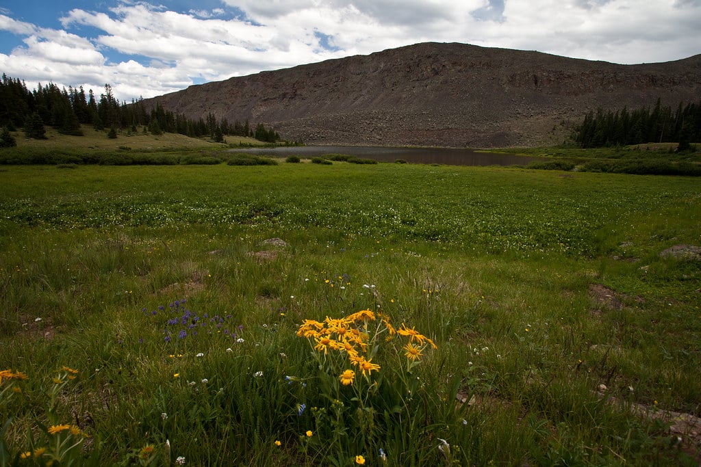
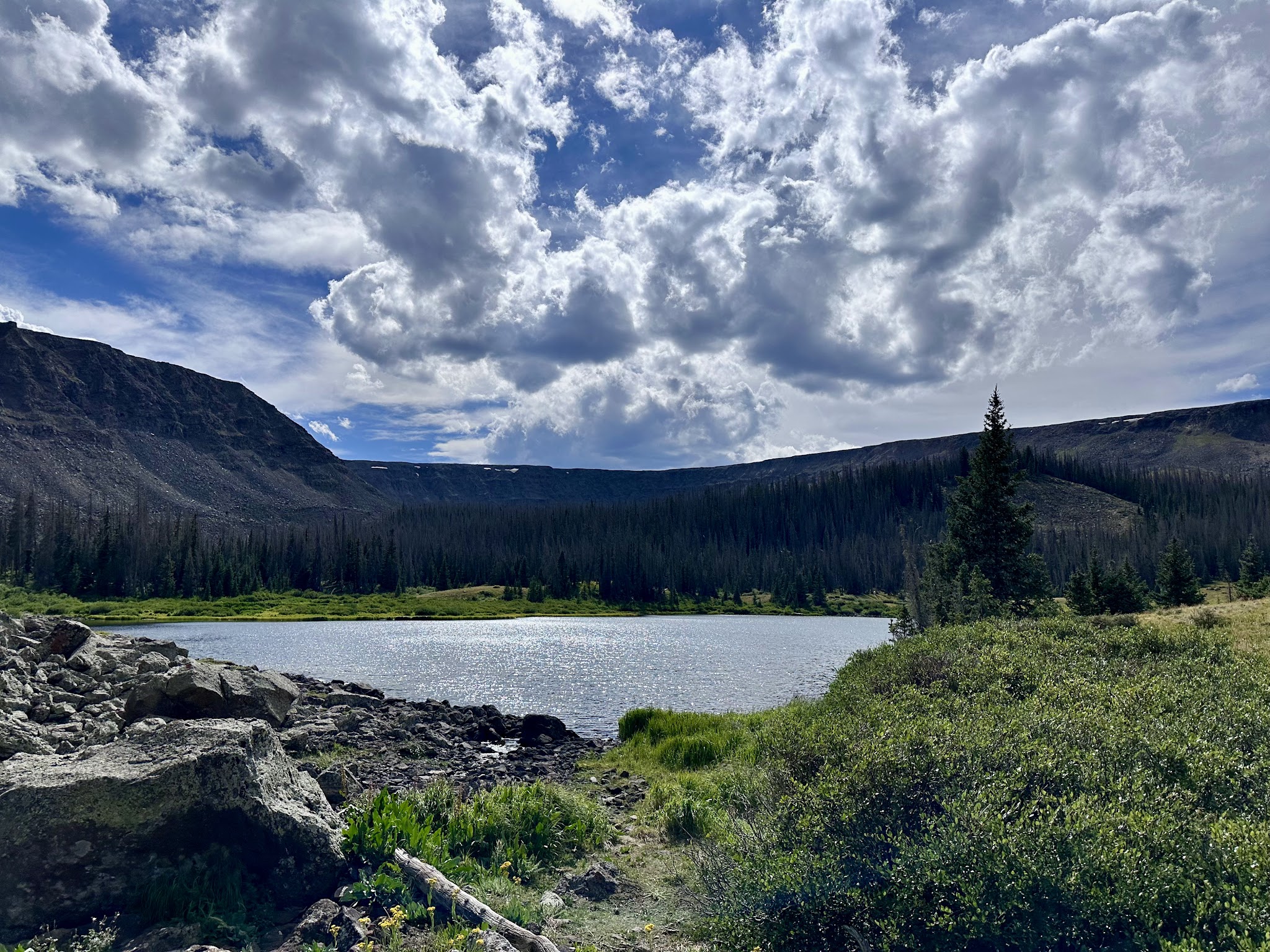
Explore the breathtaking alpine beauty of Powderhorn Wilderness, a remote haven located near Lake City, Colorado. This magnificent high-altitude area is renowned for its vast expanses of tundra, secluded lakes, and miles of pet-friendly hiking trails. Dog owners will love the unparalleled space to roam, with over 45 miles of trails like the scenic Devil’s Lake Trail. Although there are no traditional dog park amenities here, the natural setting offers a true backcountry experience for adventurous pups and their people.
While there are no fenced areas or designated off-leash zones, responsible pet owners are welcomed to bring their dogs for leashed hikes across rolling meadows and rugged plateaus. Due to its wilderness designation, preparedness is crucial: pack all necessary supplies for your dog and yourself, and be ready for limited cell coverage. Powderhorn Wilderness is a top choice for those seeking dog-friendly hikes in a truly wild Colorado setting.
Powderhorn Wilderness Dog Park FAQ
- Are there walking or hiking trails connected to the park? Yes, the area offers about 45 miles of hiking trails, including the scenic Devil’s Lake Trail.
- Is there a swimming area or pond for dogs? While there are fish-filled lakes and alpine meadows, specific dog swimming spots are not designated, but well-behaved dogs may swim in natural lakes at owners’ discretion.
- Is the park open year-round? Yes, the wilderness area is open year-round, though weather conditions can vary dramatically at high elevations.
- Are there shade or shelter available? There are natural shade areas from trees like aspen, pine, spruce, and fir in the lower elevations.
- Are there staff or rangers present at the park? The area is managed by the Gunnison National Forest and Bureau of Land Management, but staff or rangers are not regularly present due to its wilderness nature.
- Are there other dog parks or trails nearby? Powderhorn Wilderness itself is a vast trail network; many pet-friendly trails extend throughout the region.
Reviews
Amazing area if you’re looking to get away from it all. Very little cell coverage and enough room to get lost – heavenly. Bring your A game though – a lot of the area is well over 10,000 feet with much of it in the 12,000 feet range.
Amazing area if you’re looking to get away from it all. Very little cell coverage and enough room to get lost – heavenly. Bring your A game though – a lot of the area is well over 10,000 feet with much of it in the 12,000 feet range.
Amazing area if you’re looking to get away from it all. Very little cell coverage and enough room to get lost – heavenly. Bring your A game though – a lot of the area is well over 10,000 feet with much of it in the 12,000 feet range.
such a beautiful area – the views are amazing
be prepared – bring supplies (don’t forget to take everything with you when you leave)
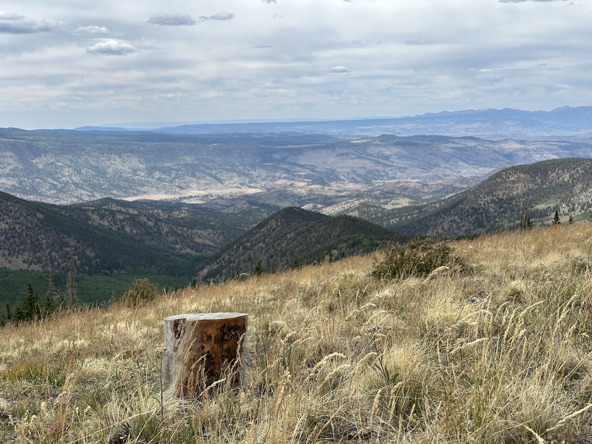
In this Wilderness, the northern verge of the San Juan Mountains reaches out into the Gunnison Basin, a dry land of sagebrush meadows dotted with fish-filled lakes, including Powderhorn Lakes. Scoured by glaciation, the Calf Creek and Cannibal Plateaus are said to be the largest unbroken expanses of alpine tundra in the Lower 48, and the feeling of sheer vastness unparalleled in Colorado. You’ll discover terrain rolling along at around 12,000 feet with views of even higher mountains in the Elk, Sawatch, and San Juan Ranges, broken only by several escarpments that stand especially lovely in the light of the setting sun. Cannibal Plateau was named for Colorado’s famous man-eater, Alferd Packer, who supposedly dined on five friends while lost near here during the winter of 1874. Elk and mule deer roam the plateaus and pass through the stands of aspen, pine, spruce, and fir that blanket the lower elevations.
The southern one-fourth of Powderhorn is managed by Gunnison National Forest, and the northern three-fourths by the Bureau of Land Management. About 45 miles of trails access this seldom-visited area. For an easily accessible hike into the backcountry, take the Devil’s Lake Trail for 6.5 miles and find a jewel of water set in a treeless alpine meadow high on the plateau.
—
LATITUDE/LONGITUDE: 38.135912, -107.146013
DIRECTIONS: From Salida, CO to Gunnison Field Office
1).Turn right onto US-50 W/?W Rainbow Blvd. Continue to follow US-50 W 3.9 miles
2). Turn right onto US-285 N/?US-50 W (signs for Gunnison/Buena Vista/Leadville) Continue to follow US-50 W. 60.4 miles
3). Turn left onto 11th St. Destination will be on the left 0.4 miles
such a beautiful area – the views are amazing
be prepared – bring supplies (don’t forget to take everything with you when you leave)
In this Wilderness, the northern verge of the San Juan Mountains reaches out into the Gunnison Basin, a dry land of sagebrush meadows dotted with fish-filled lakes, including Powderhorn Lakes. Scoured by glaciation, the Calf Creek and Cannibal Plateaus are said to be the largest unbroken expanses of alpine tundra in the Lower 48, and the feeling of sheer vastness unparalleled in Colorado. You’ll discover terrain rolling along at around 12,000 feet with views of even higher mountains in the Elk, Sawatch, and San Juan Ranges, broken only by several escarpments that stand especially lovely in the light of the setting sun. Cannibal Plateau was named for Colorado’s famous man-eater, Alferd Packer, who supposedly dined on five friends while lost near here during the winter of 1874. Elk and mule deer roam the plateaus and pass through the stands of aspen, pine, spruce, and fir that blanket the lower elevations.
The southern one-fourth of Powderhorn is managed by Gunnison National Forest, and the northern three-fourths by the Bureau of Land Management. About 45 miles of trails access this seldom-visited area. For an easily accessible hike into the backcountry, take the Devil’s Lake Trail for 6.5 miles and find a jewel of water set in a treeless alpine meadow high on the plateau.
—
LATITUDE/LONGITUDE: 38.135912, -107.146013
DIRECTIONS: From Salida, CO to Gunnison Field Office
1).Turn right onto US-50 W/?W Rainbow Blvd. Continue to follow US-50 W 3.9 miles
2). Turn right onto US-285 N/?US-50 W (signs for Gunnison/Buena Vista/Leadville) Continue to follow US-50 W. 60.4 miles
3). Turn left onto 11th St. Destination will be on the left 0.4 miles