Observatory Trail Head - Palomar Mountain, CA
Observatory Trail Head Dog-Friendly Hiking in Palomar Mountain, California
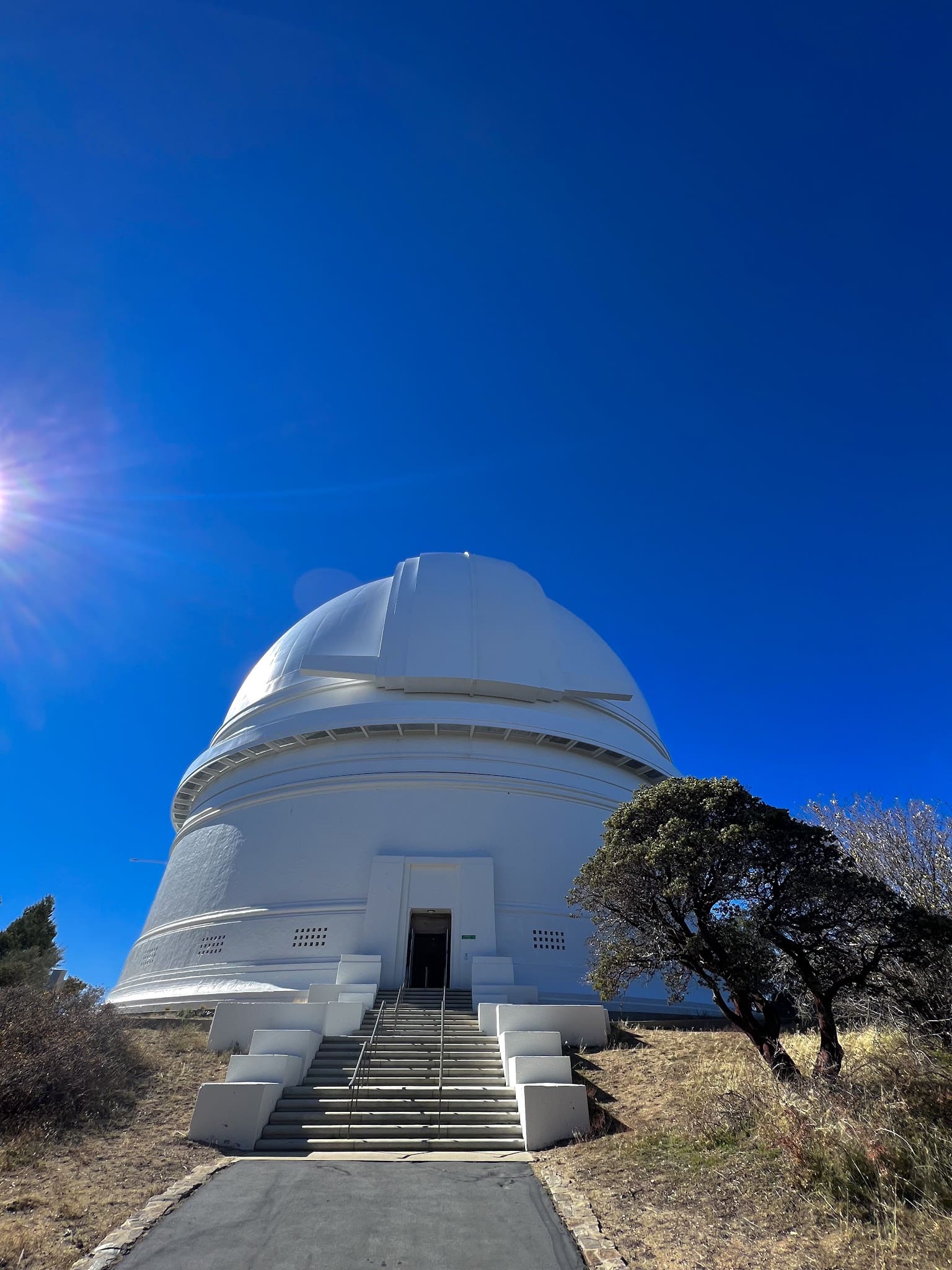
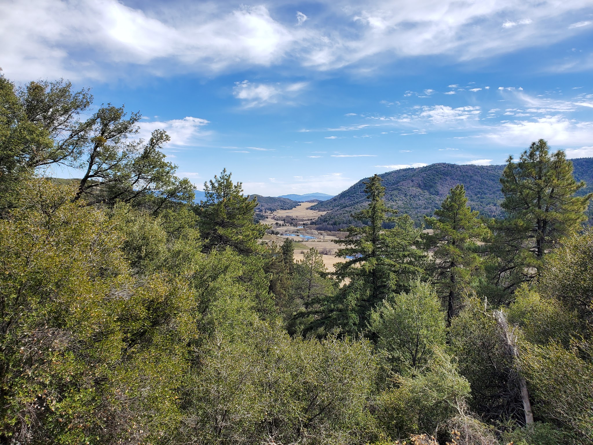
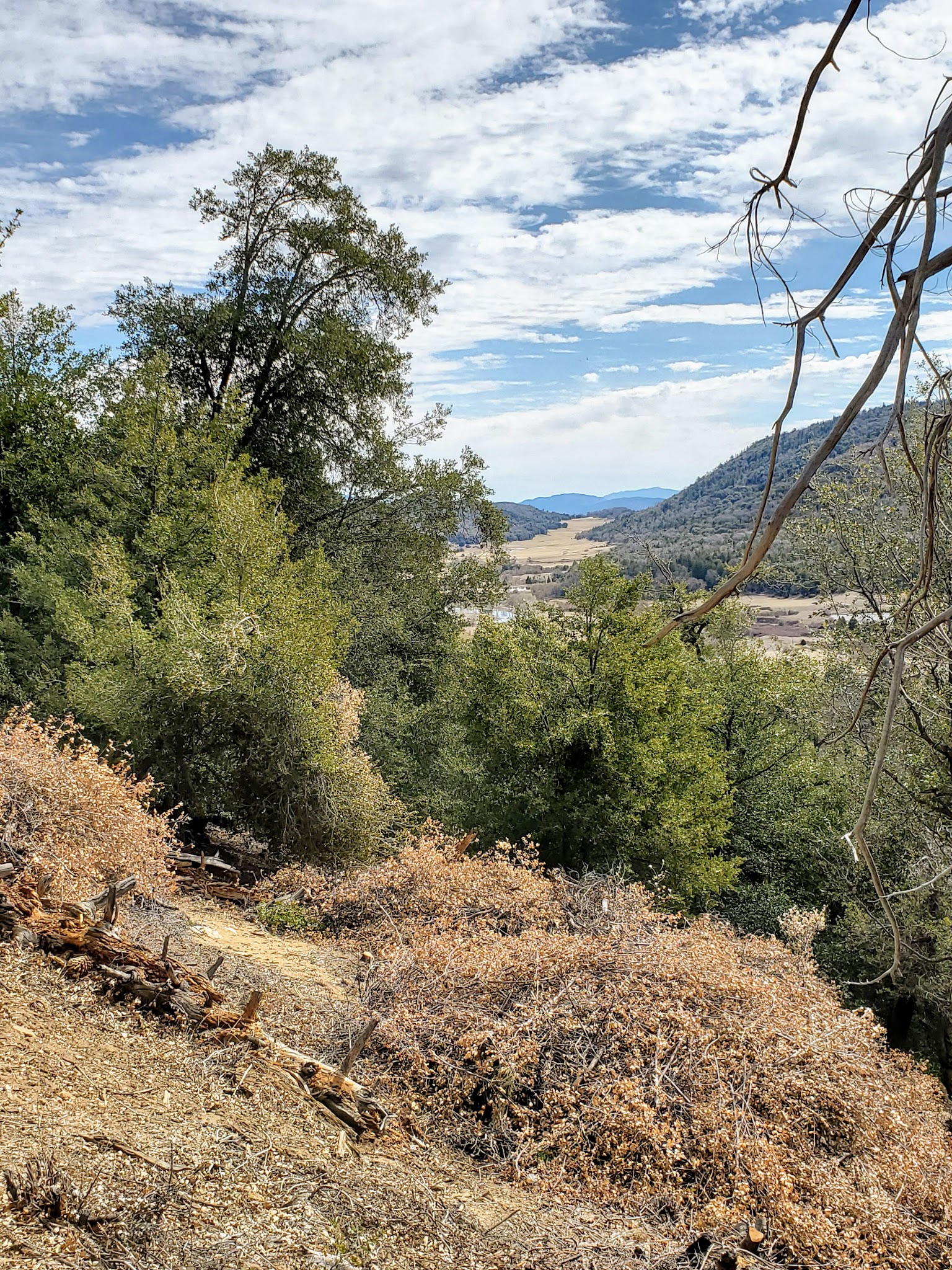
If you’re looking for a scenic dog park in Palomar Mountain, California, the Observatory Trail Head is a fantastic choice for active dog owners and their furry companions. Located at Co Hwy S6, near the famous Hale Telescope and visitor center, the trail offers pet-friendly, forested hiking with beautiful views and plenty of nature to explore. The hike varies in difficulty, with options ranging from easy one-and-a-half mile loops to more challenging three mile inclines — perfect for breaking a sweat with your pup.
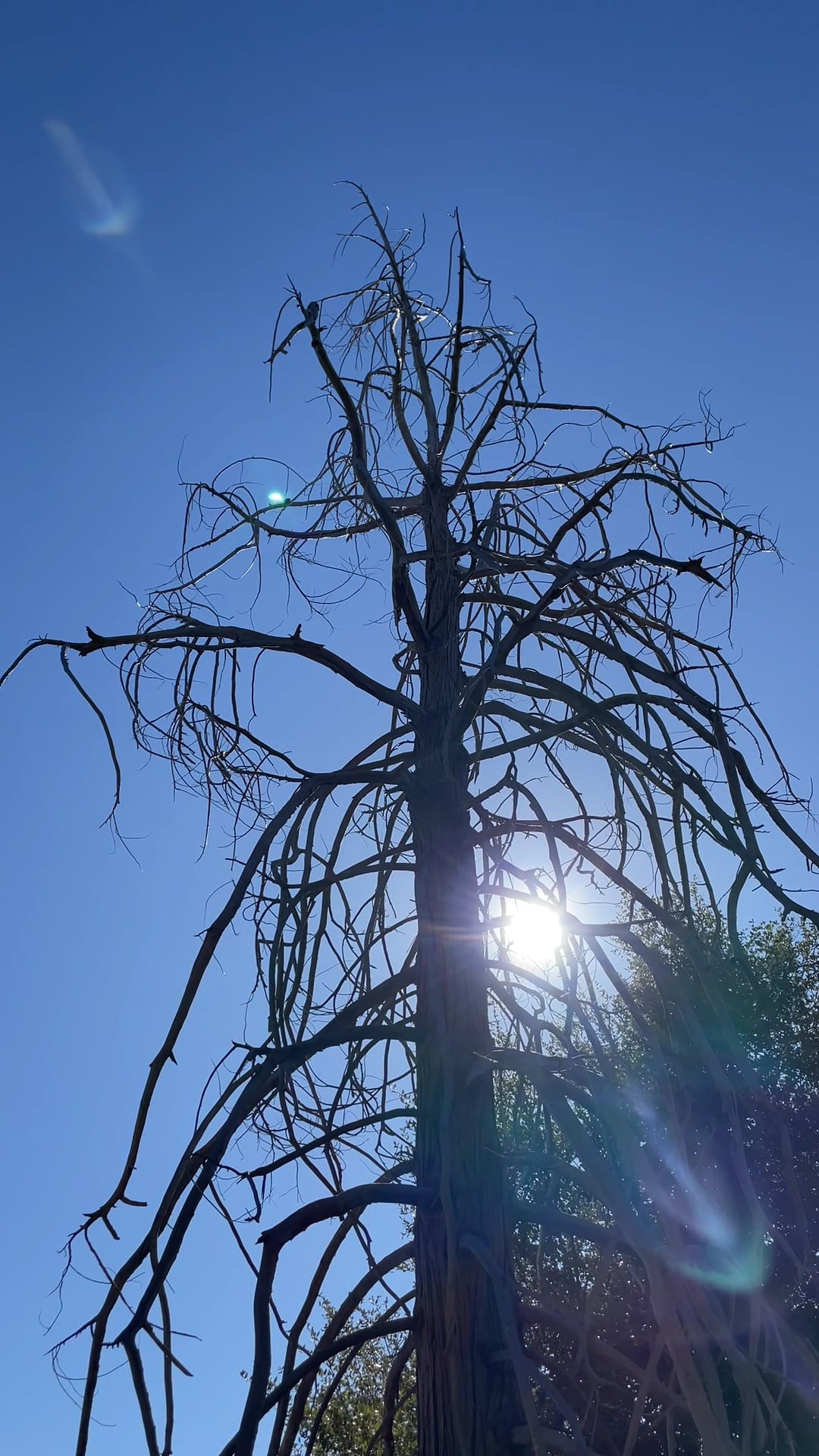
The trails wind through dense, shaded woods at around 5,000 feet elevation, providing cool refuge during warmer weather. You’ll find natural water features in the spring and dramatic foliage throughout the seasons. While there is a small parking fee, the area is very well maintained by attentive staff, and restrooms are available near the main trailhead. Please note, parking access may vary in the off-season but several alternative entry points are available nearby.
Frequently Asked Questions
- Are there restrooms available for owners? Yes, restrooms are available by the main trailhead, though some may be closed in the off-season.
- Is there shade or shelter available? Yes, the trail provides good natural shade from tall, dense trees.
- Is there a fee or membership required to enter? Yes, there is a small parking fee to access the trail.
- Is the park regularly cleaned and maintained? Yes, the area is kept clean and safe by regular staff members.
- Are there walking or hiking trails connected to the park? Yes, the Observatory Trail offers a variety of hiking options for all fitness levels.
- Where is the best place to park? The best parking is at the Observatory Campground if open; otherwise, there are pullouts along SR-6 or across from Fry Creek Campground.
Reviews
The trail actually begins in the campground which closes for the season around Dec 2nd ( at least that’s how it aligned in 2024). Therefore, we parked in a pullout along SR-6 and hoofed it through the campground to the trailhead. The bathrooms by the trailhead were unlocked however others were posted as closed. The color we saw along this trail to the Observatory was incredible. The trail was up there, I’d say a 6-7/10 difficultly rating although the descent goes by in a fraction of the time. Lots of rocks and in the Spring, there will be numerous water crossings (I counted at least four that were really obvious). When you’re on the trail you feel like you’re truly in the woods. Due to it being 5,000 ft. in elevation, the trees are tall and dense and the trail did have some shade although still not for me in the heat. The fun part is emerging at the end of SR-6 at the Observatory. You pop out and there’s the parking lot, visitor center, and the Hale Telescope. Take the time to go in and see the telescope. It is quite an impressive sight!
The trail actually begins in the campground which closes for the season around Dec 2nd ( at least that’s how it aligned in 2024). Therefore, we parked in a pullout along SR-6 and hoofed it through the campground to the trailhead. The bathrooms by the trailhead were unlocked however others were posted as closed. The color we saw along this trail to the Observatory was incredible. The trail was up there, I’d say a 6-7/10 difficultly rating although the descent goes by in a fraction of the time. Lots of rocks and in the Spring, there will be numerous water crossings (I counted at least four that were really obvious). When you’re on the trail you feel like you’re truly in the woods. Due to it being 5,000 ft. in elevation, the trees are tall and dense and the trail did have some shade although still not for me in the heat. The fun part is emerging at the end of SR-6 at the Observatory. You pop out and there’s the parking lot, visitor center, and the Hale Telescope. Take the time to go in and see the telescope. It is quite an impressive sight!
The trail actually begins in the campground which closes for the season around Dec 2nd ( at least that’s how it aligned in 2024). Therefore, we parked in a pullout along SR-6 and hoofed it through the campground to the trailhead. The bathrooms by the trailhead were unlocked however others were posted as closed. The color we saw along this trail to the Observatory was incredible. The trail was up there, I’d say a 6-7/10 difficultly rating although the descent goes by in a fraction of the time. Lots of rocks and in the Spring, there will be numerous water crossings (I counted at least four that were really obvious). When you’re on the trail you feel like you’re truly in the woods. Due to it being 5,000 ft. in elevation, the trees are tall and dense and the trail did have some shade although still not for me in the heat. The fun part is emerging at the end of SR-6 at the Observatory. You pop out and there’s the parking lot, visitor center, and the Hale Telescope. Take the time to go in and see the telescope. It is quite an impressive sight!
Nice hike with no one on it. The trail was hard to follow since the leaves were covering the path. The snow was melting at the time so parts of the path was flooded with water. Something to consider when planning your trip.
Nice hike with no one on it. The trail was hard to follow since the leaves were covering the path. The snow was melting at the time so parts of the path was flooded with water. Something to consider when planning your trip.
Nice hike with no one on it. The trail was hard to follow since the leaves were covering the path. The snow was melting at the time so parts of the path was flooded with water. Something to consider when planning your trip.
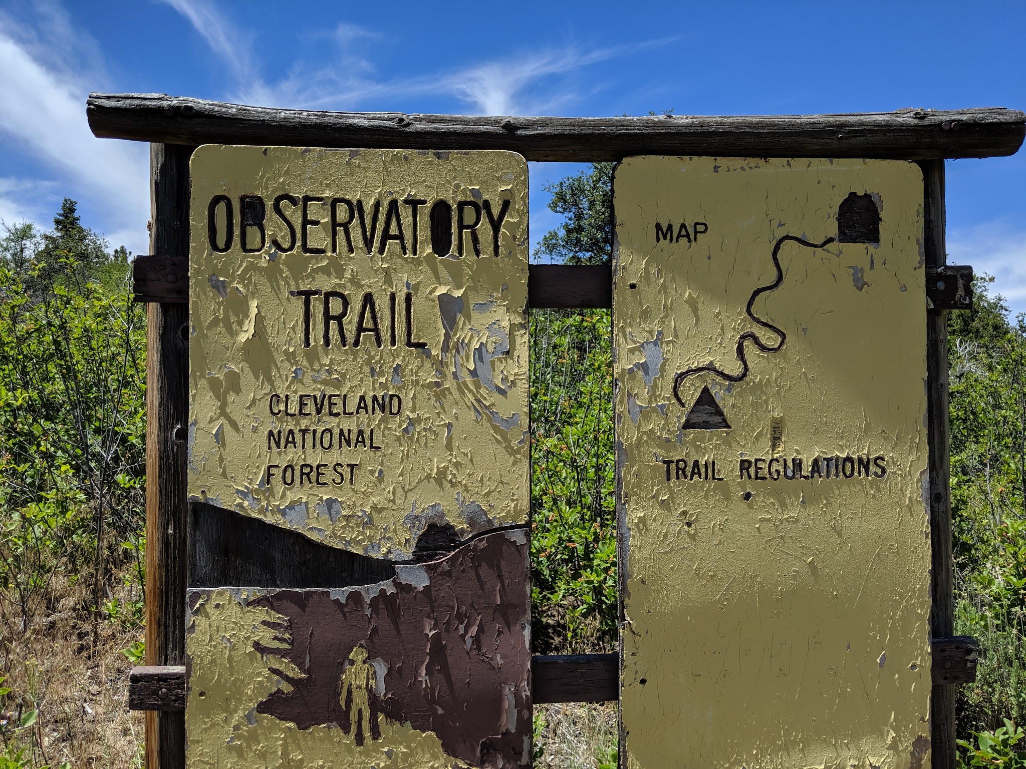
Finding this trail was challenging using Google Maps. But, we found two ways to identify the trailhead. First, the easiest way is to enter through the Observatory Campground road if it’s open. You can park in the public parking lot where the bathrooms are and before you make it to the campgrounds.
The second way is to park right across from Fry Creek Campground and enter down the trail by the trailhead sign. I added photos for reference!
Other than that, we didn’t finish the trail this time but it was beautiful out there!
A Great trail! A lot of uphill climbing is involved so definitely intermediate in terms of trails . Beautiful scenic views and nature.