Fortune's Cove Preserve - Lovingston, VA
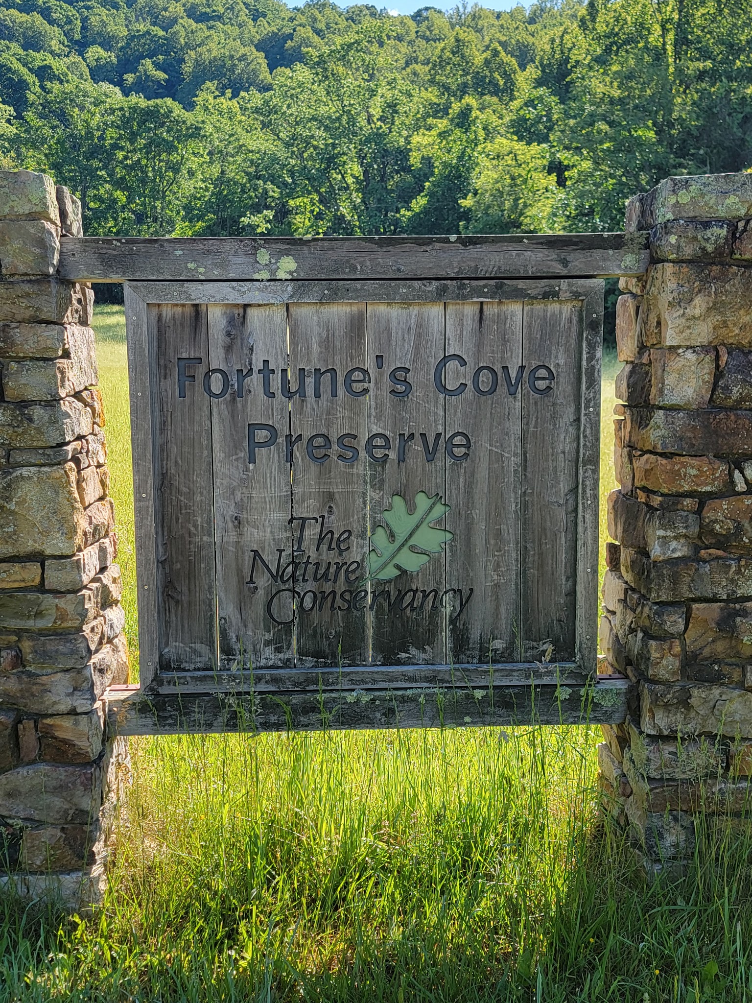

Fortune’s Cove Preserve: Hiking & Nature Near Lovingston, Virginia
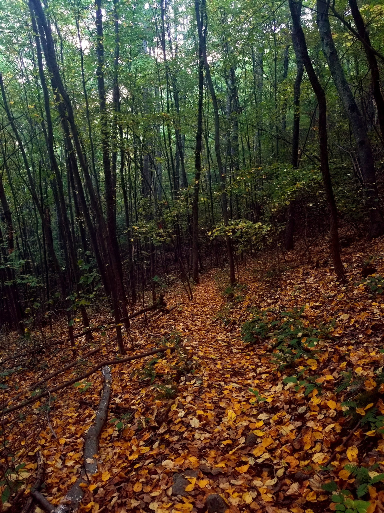
Fortune’s Cove Preserve, nestled near Lovingston, VA, is a beloved yet lesser-known natural area featuring scenic trails and stunning mountain views. Although not designated as a traditional dog park, this preserve offers moderate to strenuous pet-friendly hiking opportunities ideal for adventure seekers and their leashed companions. The White and Yellow trails vary from 4 to nearly 6 miles, rewarding hikers with panoramic overlooks, dense woodlands, and a peaceful escape from the crowds found at more popular hiking destinations.
Hikers will appreciate the well-marked trails, small parking lot, and tranquil ambiance. Do note there are no restrooms, garbage cans, or water stations, so visitors should come prepared with essentials—including water for themselves and their pets, as well as waste bags. While there isn’t a fenced or off-leash dog area, the preserve’s rugged hikes and beautiful vistas make it a top choice for dog-friendly hiking in Lovingston, Virginia.
FAQ
- Are dogs allowed off-leash at this park? No, dogs must remain on-leash at all times.
- Is there a fenced area for dogs? No, there are no fenced dog areas in the preserve.
- Are there restrooms available for owners? No, there are no restroom facilities available.
- Are there benches or seating areas for owners? No benches or picnic tables are provided—plan for limited amenities.
- Where is the best place to park? There is a small parking lot at the base of the trail; arrive early on weekends as it can fill up quickly.
- Are ticks or other pests common in the area? Yes, ticks can be prevalent—use repellant and check pets after hiking.
- Are there walking or hiking trails connected to the park? Yes, the preserve is known for its loop hiking trails with varying levels of difficulty.
Reviews
There are 2 trails in the relatively small wilderness preserve that’s not all that well known. Since we start relatively late in the afternoon we take the smaller trail called the White trail and is approximately 4.1 miles. It’s considered moderate in difficulty as you climb roughly 1.2 miles to a pretty nice overlook and then it’s pretty much downhill all the way back. It’s a pretty nice hike through the woods with a lot of varied terrain and a pretty well marked trail. Note this trail is combined with the Yellow trail at the beginning and end so don’t get too confused with the yellow markers, you’re still on the correct trail. If you have the time and energy the view is supposed to be outstanding at the top of the Yellow trail, which is 5.8 miles and considered difficult/strenuous due to the elevation gain on steep trails. So if you’re in the area and want to hike in an area that’s a little out of the way then stop by. By the way its a small parking lot so get there early on the weekend or go during the week.
There are 2 trails in the relatively small wilderness preserve that’s not all that well known. Since we start relatively late in the afternoon we take the smaller trail called the White trail and is approximately 4.1 miles. It’s considered moderate in difficulty as you climb roughly 1.2 miles to a pretty nice overlook and then it’s pretty much downhill all the way back. It’s a pretty nice hike through the woods with a lot of varied terrain and a pretty well marked trail. Note this trail is combined with the Yellow trail at the beginning and end so don’t get too confused with the yellow markers, you’re still on the correct trail. If you have the time and energy the view is supposed to be outstanding at the top of the Yellow trail, which is 5.8 miles and considered difficult/strenuous due to the elevation gain on steep trails. So if you’re in the area and want to hike in an area that’s a little out of the way then stop by. By the way its a small parking lot so get there early on the weekend or go during the week.
There are 2 trails in the relatively small wilderness preserve that’s not all that well known. Since we start relatively late in the afternoon we take the smaller trail called the White trail and is approximately 4.1 miles. It’s considered moderate in difficulty as you climb roughly 1.2 miles to a pretty nice overlook and then it’s pretty much downhill all the way back. It’s a pretty nice hike through the woods with a lot of varied terrain and a pretty well marked trail. Note this trail is combined with the Yellow trail at the beginning and end so don’t get too confused with the yellow markers, you’re still on the correct trail. If you have the time and energy the view is supposed to be outstanding at the top of the Yellow trail, which is 5.8 miles and considered difficult/strenuous due to the elevation gain on steep trails. So if you’re in the area and want to hike in an area that’s a little out of the way then stop by. By the way its a small parking lot so get there early on the weekend or go during the week.
This is a moderate hike, with spots that can be dangerous if you’re not careful, but it is just breathtakingly beautiful!! FYI…If you take the upper loop, it is over an 8 mile hike total, and if you take the lower loop, it’s around 5 miles. Bring water and snacks! Also, I highly recommend wearing pants as there is a lot of poison ivy on the trails. The upper loop isn’t traveled as much, but it is worth the extra walk. Also, spray repellant of some sort if possible because the ticks are terrible!
This is a moderate hike, with spots that can be dangerous if you’re not careful, but it is just breathtakingly beautiful!! FYI…If you take the upper loop, it is over an 8 mile hike total, and if you take the lower loop, it’s around 5 miles. Bring water and snacks! Also, I highly recommend wearing pants as there is a lot of poison ivy on the trails. The upper loop isn’t traveled as much, but it is worth the extra walk. Also, spray repellant of some sort if possible because the ticks are terrible!
This is a moderate hike, with spots that can be dangerous if you’re not careful, but it is just breathtakingly beautiful!! FYI…If you take the upper loop, it is over an 8 mile hike total, and if you take the lower loop, it’s around 5 miles. Bring water and snacks! Also, I highly recommend wearing pants as there is a lot of poison ivy on the trails. The upper loop isn’t traveled as much, but it is worth the extra walk. Also, spray repellant of some sort if possible because the ticks are terrible!
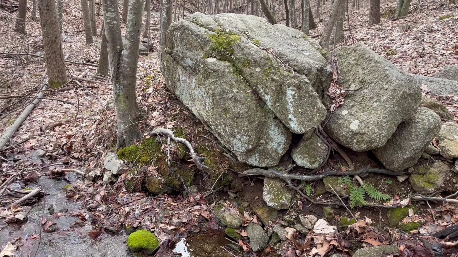
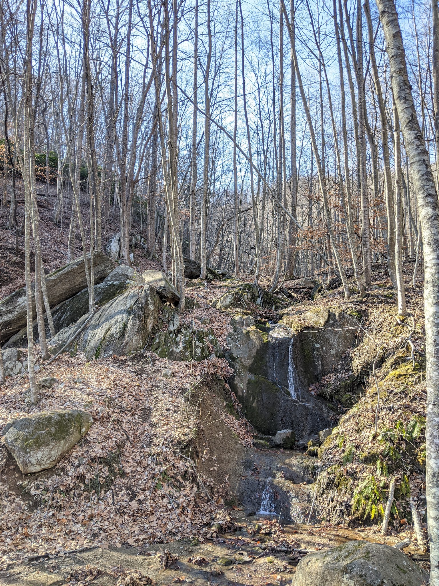
FYI: No dogs allowed. Google maps took us right to the parking lot. The trail starts across the road from the driveway leading to the parking lot. We did the shorter White Trail hike. According to the signs this is a 3.7 mile hike but both of our Apple Watches registered it as just over 4 miles. This hike starts out very steep for the first mile and then mostly goes down hill for the next 3 miles until you return to the road just below the parking lot. Surprisingly, we saw very little wildlife at the end of February but it was only 41 degrees. With all of the leaves down you can really see the terrain and rock formations. There are no bathrooms or garbage cans at the parking lot. Signs in English and Spanish. The trail is well maintained with several bridges over the small creeks.
FYI: No dogs allowed. Google maps took us right to the parking lot. The trail starts across the road from the driveway leading to the parking lot. We did the shorter White Trail hike. According to the signs this is a 3.7 mile hike but both of our Apple Watches registered it as just over 4 miles. This hike starts out very steep for the first mile and then mostly goes down hill for the next 3 miles until you return to the road just below the parking lot. Surprisingly, we saw very little wildlife at the end of February but it was only 41 degrees. With all of the leaves down you can really see the terrain and rock formations. There are no bathrooms or garbage cans at the parking lot. Signs in English and Spanish. The trail is well maintained with several bridges over the small creeks.
FYI: No dogs allowed. Google maps took us right to the parking lot. The trail starts across the road from the driveway leading to the parking lot. We did the shorter White Trail hike. According to the signs this is a 3.7 mile hike but both of our Apple Watches registered it as just over 4 miles. This hike starts out very steep for the first mile and then mostly goes down hill for the next 3 miles until you return to the road just below the parking lot. Surprisingly, we saw very little wildlife at the end of February but it was only 41 degrees. With all of the leaves down you can really see the terrain and rock formations. There are no bathrooms or garbage cans at the parking lot. Signs in English and Spanish. The trail is well maintained with several bridges over the small creeks.
This is a strenuous loop trail that climbs 1400 ft in the first 3.5 miles. In fact, there’s an inner loop whose trail is shorter & less difficult. The advertised distance never seem to match up w ours. We clocked in at around 6.5 miles w stops. It will be very helpful to bring at least one trekking pole. The climb is immediate & continuous w enough leveling to catch a breath or view the valley at 7 distinct vistas. Otherwise, the foliage blocks everything as you hike the ridge. Some parts of the trail were impeded by fallen trees & overgrown plants, creating obstacles to navigate. But this only added to the unique nature of the hike. Thankfully, once we hit the summit, it was ALL downhill from there. Logged steps and the absence of rocks made the descent much easier and faster. However, the trail seemed to never end. It eventually did after 3.5 hrs.