Ashokan High Point Trailhead - West Shokan, NY
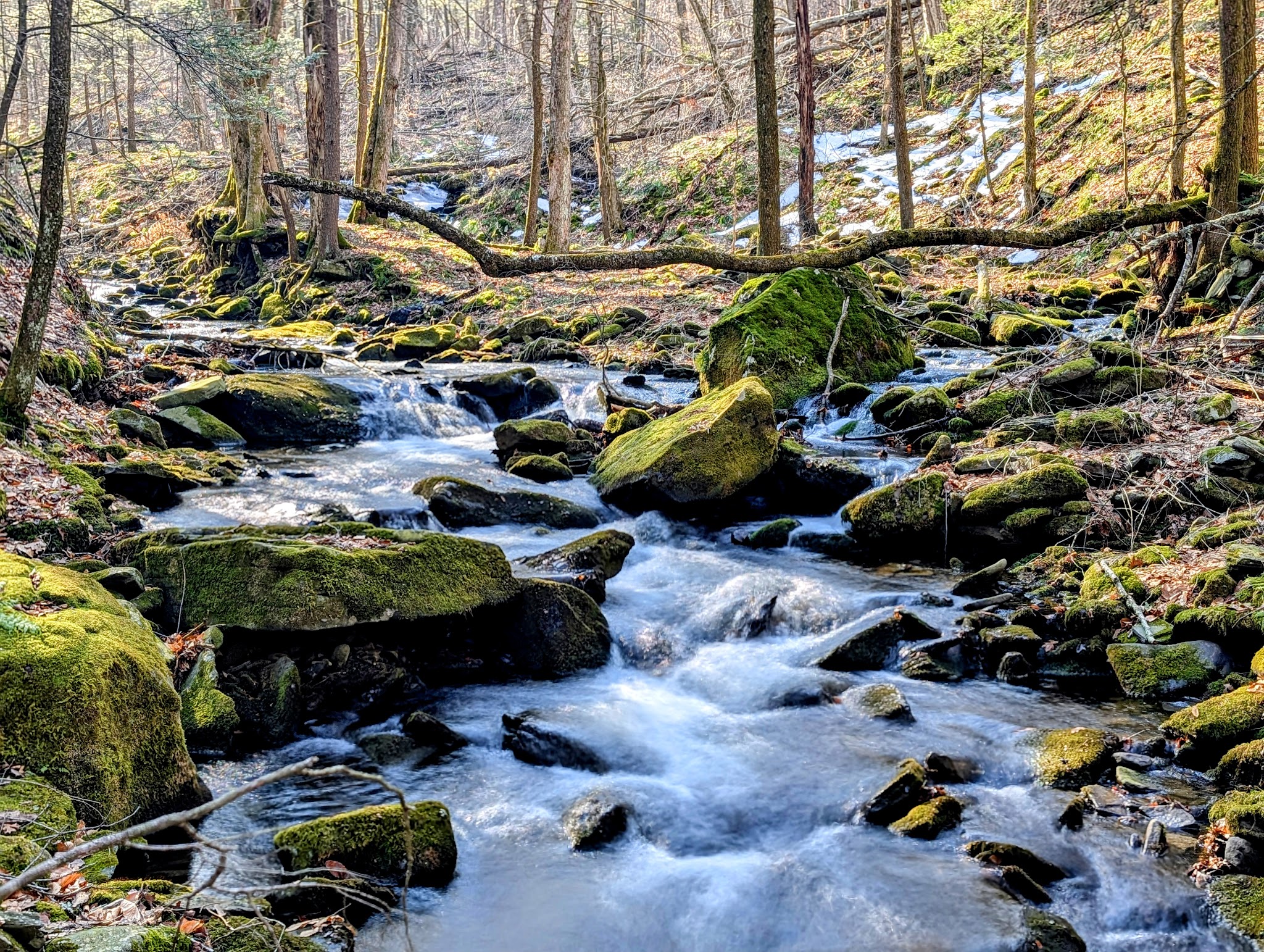
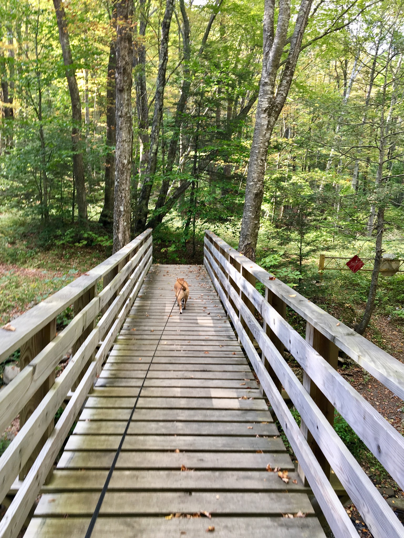
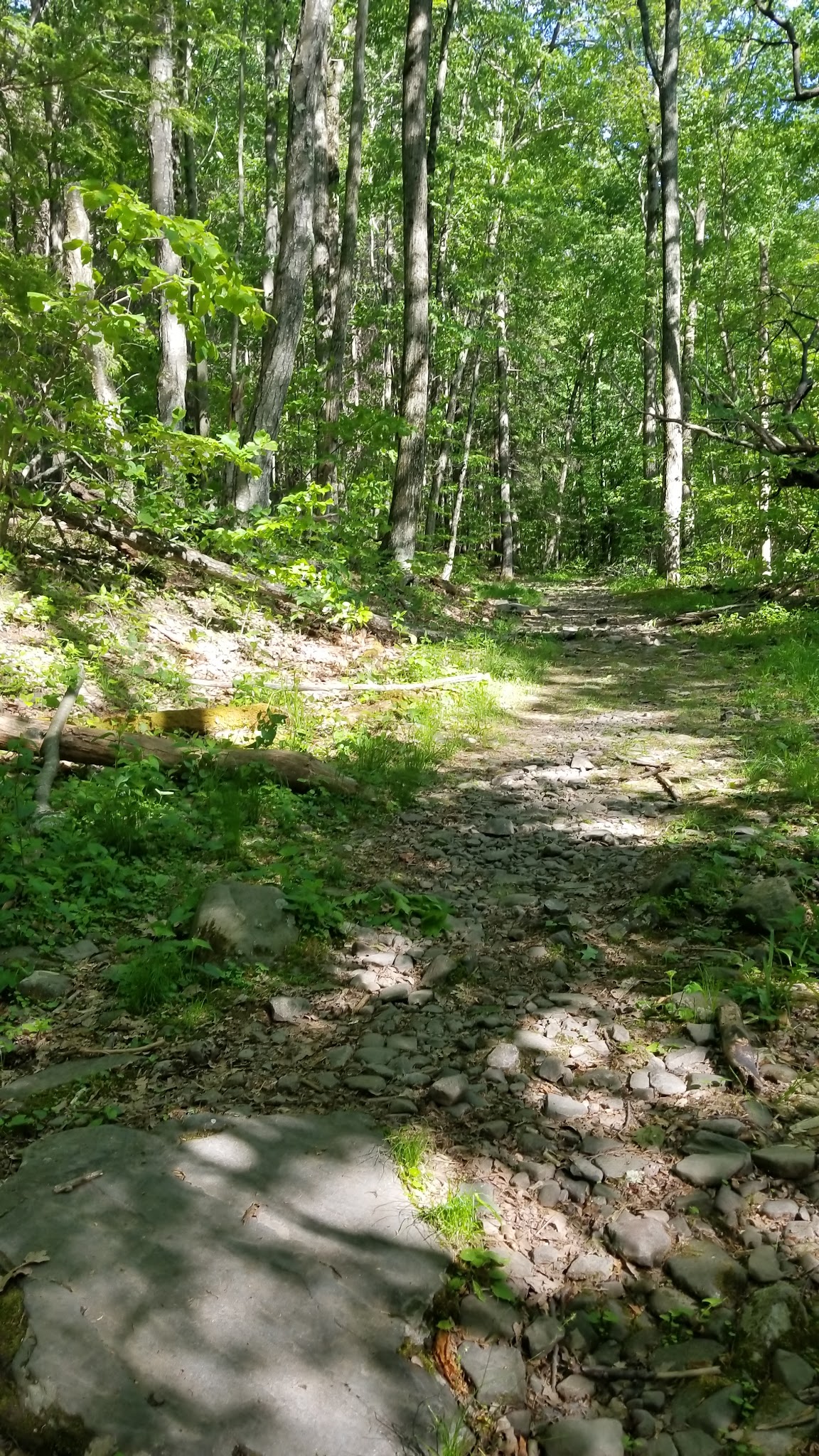
If you’re looking for a dog-friendly hiking experience in the Catskills, Ashokan High Point Trailhead is an excellent option for pet owners in West Shokan, New York. This scenic trailhead offers pet-friendly trails where leashed dogs can join you for a full-day outdoor adventure through beautiful forests, alongside Kanape Brook, and up to picturesque views. The well-marked trail begins gently before ascending toward the summit, making it ideal for active dog owners seeking a good workout with their furry companions.
The Ashokan High Point Trail is known for its natural beauty, including serene creek-side stretches, a beaver dam, and a dense pine forest section. While the park doesn’t offer typical dog park amenities like fenced areas or agility equipment, it stands out for its ample parking, peaceful wilderness vibe, and opportunities for on-leash hiking with your pet. This trail is a must-see for those looking to explore pet-friendly hiking trails in upstate New York.
FAQ about Ashokan High Point Trailhead
- Are there walking or hiking trails connected to the park? Yes, the entire park is centered around a scenic hiking trail.
- Is there a swimming area or pond for dogs? There is easy access to Kanape Brook along the trail and some trails lead to the water, which is ideal for dogs who enjoy splashing or wading.
- Where is the best place to park? There is ample parking available at the trailhead, with a bulletin board and map near the lot.
- Is there shade or shelter available? The trail passes through dense forests, providing natural shade along much of the route.
Reviews
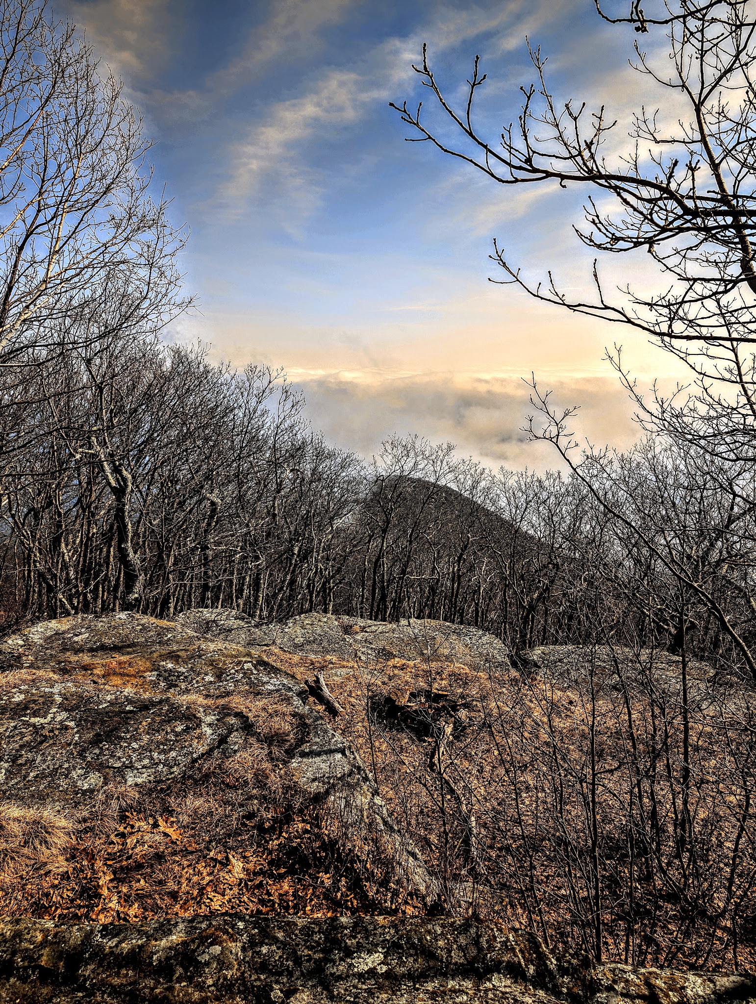
Starting at Ashokan high point trailhead this is a 10-mille lollipop. The first 3 miles is an easy gentle slope to the col between Ashokan High Point and Mombaccus mountain. This section is an old forest road along Kanape brook. After that the trail turns toward the summit and becomes steeper, nothing crazy but a good workout. There is a decent view at the top ledge and a couple of obscured views on the way up and down. The return section of the loop goes through the dense mountain laurel section and is overgrown in places. The “down” portion is steep and rocky, again nothing crazy but ankle-turners are aplenty. Feels like a very degraded old forest road. This is a whole day hike, so prepare accordingly
Starting at Ashokan high point trailhead this is a 10-mille lollipop. The first 3 miles is an easy gentle slope to the col between Ashokan High Point and Mombaccus mountain. This section is an old forest road along Kanape brook. After that the trail turns toward the summit and becomes steeper, nothing crazy but a good workout. There is a decent view at the top ledge and a couple of obscured views on the way up and down. The return section of the loop goes through the dense mountain laurel section and is overgrown in places. The “down” portion is steep and rocky, again nothing crazy but ankle-turners are aplenty. Feels like a very degraded old forest road. This is a whole day hike, so prepare accordingly
Starting at Ashokan high point trailhead this is a 10-mille lollipop. The first 3 miles is an easy gentle slope to the col between Ashokan High Point and Mombaccus mountain. This section is an old forest road along Kanape brook. After that the trail turns toward the summit and becomes steeper, nothing crazy but a good workout. There is a decent view at the top ledge and a couple of obscured views on the way up and down. The return section of the loop goes through the dense mountain laurel section and is overgrown in places. The “down” portion is steep and rocky, again nothing crazy but ankle-turners are aplenty. Feels like a very degraded old forest road. This is a whole day hike, so prepare accordingly
Ample parking for a nice trail. Trail is easy to follow. There’s a bulletin board with a map posted at the parking area. There’s really only one nice view on this trail.
Ample parking for a nice trail. Trail is easy to follow. There’s a bulletin board with a map posted at the parking area. There’s really only one nice view on this trail.
Ample parking for a nice trail. Trail is easy to follow. There’s a bulletin board with a map posted at the parking area. There’s really only one nice view on this trail.
This trail was really beautiful, if you choose not to walk up and through the designated path there’s a little trail off to the side that brings you to a bunch of canoes locked to trees and rocks that lead to the water. It’s serene and peaceful. A must see in the area with a beautiful drive to the spot.
This trail was really beautiful, if you choose not to walk up and through the designated path there’s a little trail off to the side that brings you to a bunch of canoes locked to trees and rocks that lead to the water. It’s serene and peaceful. A must see in the area with a beautiful drive to the spot.
This trail was really beautiful, if you choose not to walk up and through the designated path there’s a little trail off to the side that brings you to a bunch of canoes locked to trees and rocks that lead to the water. It’s serene and peaceful. A must see in the area with a beautiful drive to the spot.
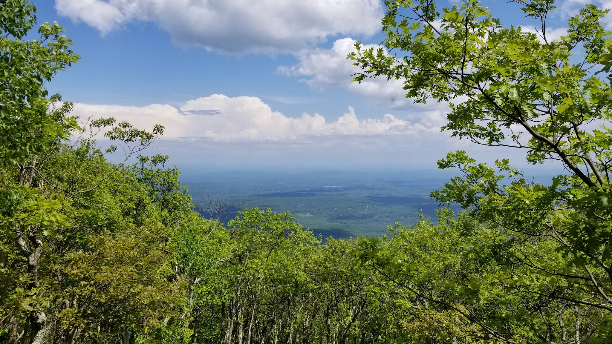
A very good trail. It starts out at a gentle slope along a river. At about an hour into it there is a huge beaver dam. Then there is a beautiful pine forest. Then the trail makes a big loop. The fork where the loop is,is bot marked so it is very hard to see on the way. If you just keep going you will end up doing the loop counterclockwise. There is one lookout spot at the top. The view is south and you can not see the reservoir. There are a few nice camping spots along the way. The whole trip including the full loop takes about 5-6 hours depending on your pace.